

This route feels like drawing a long, gentle arc across the East of England, from university cloisters to wide, tidal skies. You start in Cambridge, among punts, chapels and bookshops, then drift into smaller, more intricate places like Saffron Walden and Bury St Edmunds, where crooked timber frames, abbey ruins and Georgian fronts sit comfortably together. Ely lifts you up above the Fens, its cathedral floating over flat land and slow water, before you finally touch the North Norfolk coast at Wells-next-the-Sea and Cley, where harbours, saltmarsh and huge horizons start to take over the story.
From there, the route slides down through river and shore towns that each have their own way of meeting the water. Beccles gives you the soft light of the southern Broads; Aldeburgh leans into shingle, music and beached fishing boats; Framlingham and the Suffolk interior pull you briefly back to castles and quiet fields. Manningtree and Constable Country blur land and estuary, then Mersea Island and Heybridge Basin bring you out to the edge of the North Sea in a more low-key, estuarine way – all mudflats, barges and tidal causeways. It’s a journey of modest distances and quiet textures, where the drama comes less from peaks and cliffs and more from sky, light and long relationships with water.
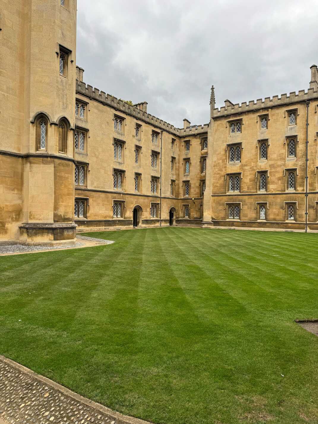
Cambridge feels like a city that lives half on the ground and half in its own reflections. You arrive to find colleges tucked behind high walls and heavy oak doors, but the river cuts through it all, levelling things out with punts drifting under willows and students wobbling along on bicycles. Walk the backs and you catch glimpses of manicured lawns, chapel spires and bridges framed by green, as if someone composed each view with quiet care.
Down in the centre, narrow streets tangle around bookshops, cafés and old passageways. The stones under your feet have been worn by centuries of scholars, but the whole place still feels light on its feet market stalls in the square, conversations in a dozen languages, music spilling from open doorways. You can join a punting tour and let someone glide you under low stone bridges, or just sit on the bank watching the river traffic. Cambridge is a soft, thoughtful starting point, full of detail if you slow down and look.
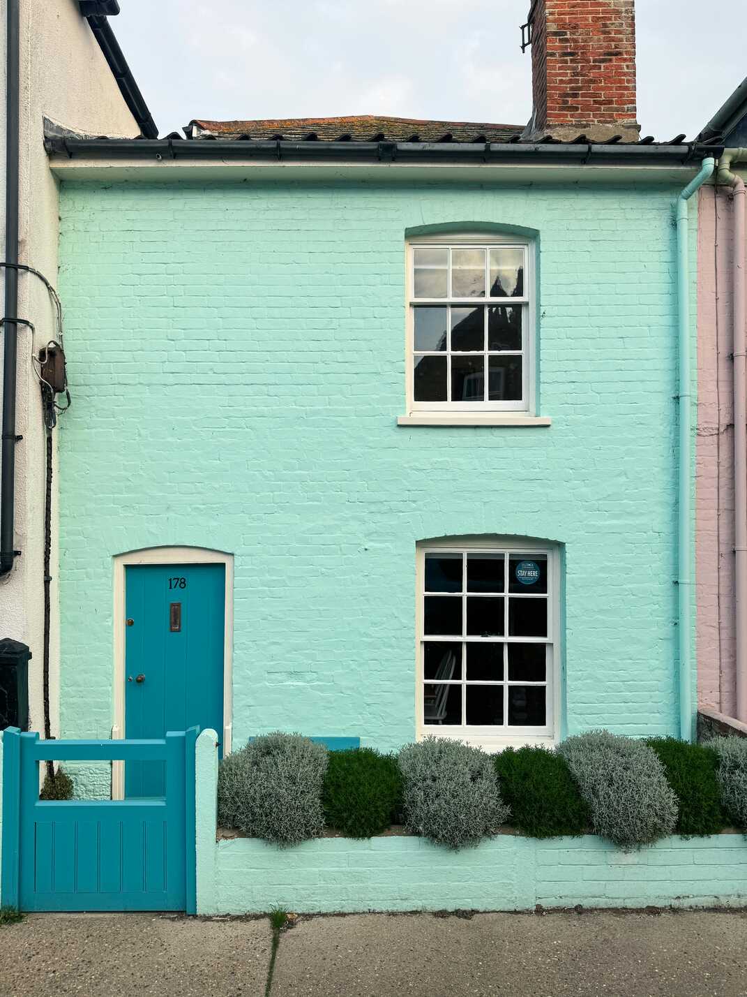
Saffron Walden wears its history lightly but it’s everywhere you look. You roll into a town of crooked timber-framed houses, pastel fronts and a market square that has been the centre of things for hundreds of years. The name itself hints at former riches this was once a hub for saffron cultivation and traces of that prosperity linger in fine old buildings and carefully carved doorways.
Wander the side streets and you’ll find little courtyards, a maze, a surprisingly grand church and that feeling of a place that has grown in layers rather than straight lines. Independent shops and cafés spill onto pavements when the weather allows, and there’s usually a quiet hum around the market. Saffron Walden feels like a gentle step down from Cambridge’s intensity: still cultured, still full of interest, but more intimate, more village-in-spirit even as it calls itself a town.
Bury St Edmunds gathers itself around ruins and gardens in a way that makes the whole centre feel like a park with a town attached. You arrive to find wide streets and handsome Georgian fronts, then slip through an old gateway into the Abbey Gardens, where the broken walls and arches of the monastery sit among lawns, borders and scattering pigeons. It’s easy to forget you’re in a working town when you’re wandering those paths.
Back outside the walls, the grid of streets holds a mix of old coaching inns, small shops and the more modern arc development, all stitched together by the smell of coffee and the murmur of people going about their day. There’s a sense of calm prosperity here: markets, theatre, a brewery with its own long story. Bury makes a comfortable hinge on this route, where medieval devotion, Georgian polish and everyday Suffolk life overlap neatly.
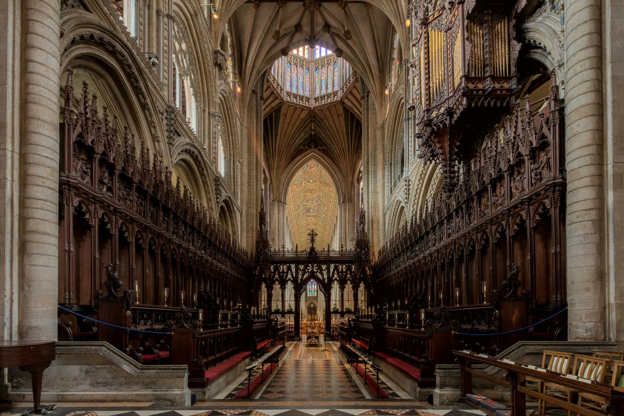
Ely rises out of the flat surrounding land like an island, which is exactly what it once was. As you approach, the cathedral – the “Ship of the Fens” – appears first, its massive lantern tower floating above fields and low houses. Drive closer and the streets tighten, bringing you to a compact centre where the cathedral precinct and small shops sit comfortably side by side.
Step inside the cathedral and the space opens in a way that’s hard to prepare for: stone and light spiralling upwards, painted ceilings, worn flags underfoot. Outside, you can wander down to the river, where narrowboats line the quay and the water lifts a little of the stillness from the landscape. The fens stretch away in great flat sheets, sky dominating everything. Ely has a calm, slightly otherworldly feel, as if it’s still a little separated from the rest of the region, and that makes it a memorable stop between inland towns and the coming coast.
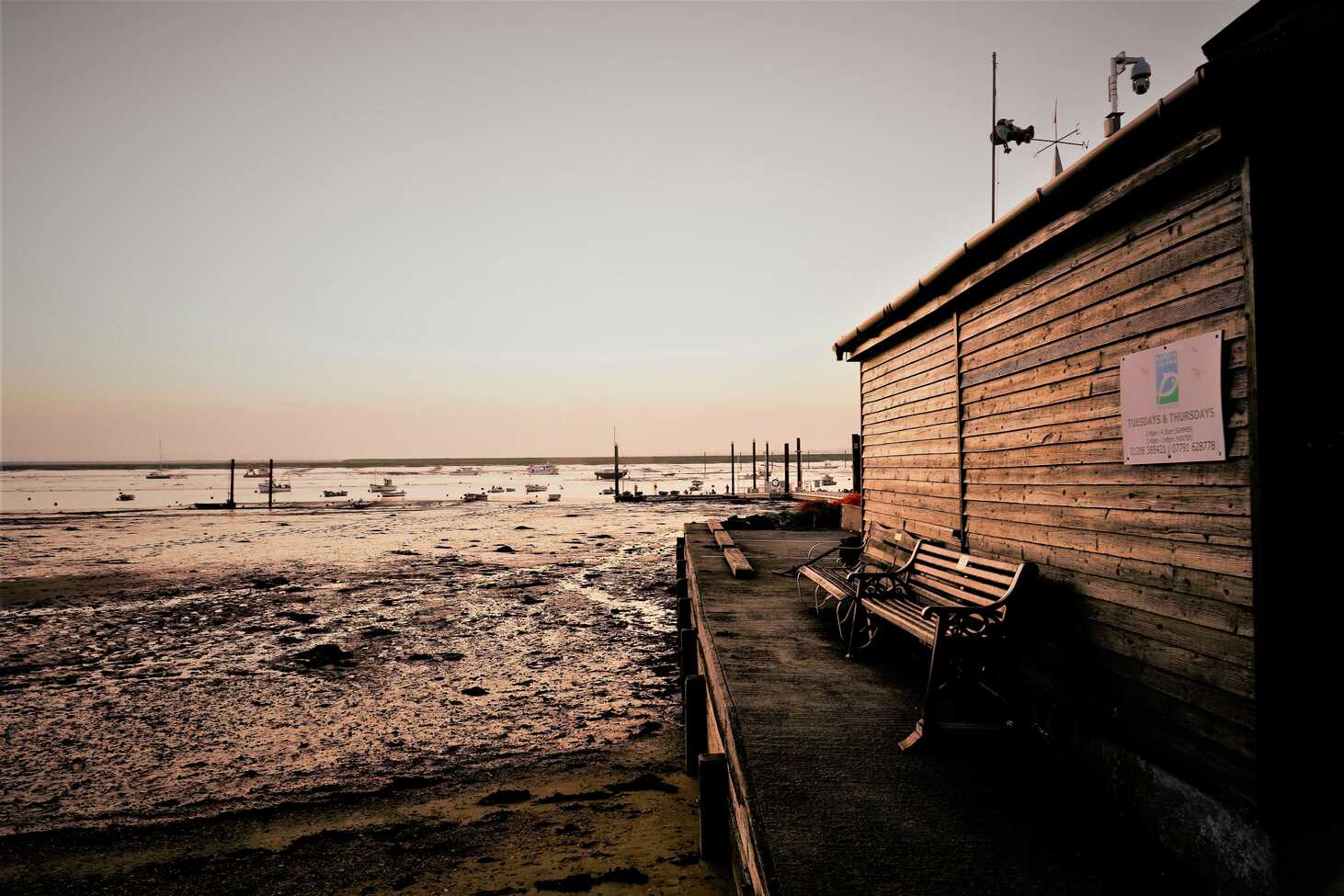
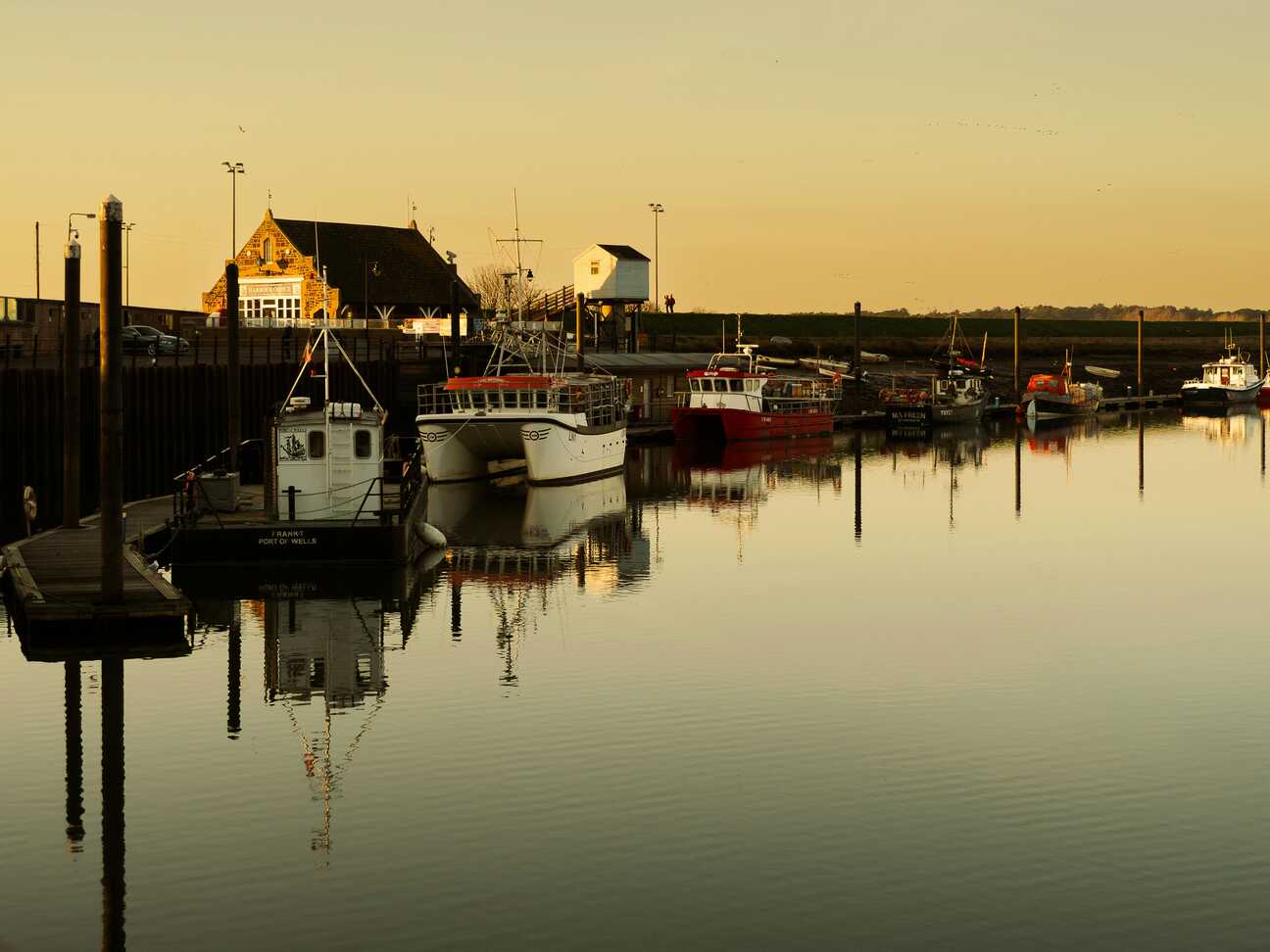
Wells-next-the-Sea feels like a working harbour and a holiday town sharing the same body. You arrive to find a long quay along a tidal creek, boats resting in the mud when the water’s out, bobbing quietly when it’s in. Old granaries and warehouses have become homes, cafés and galleries, but the smell of salt, rope and fish still hangs in the air.
Walk or take the little train out to the beach and the landscape opens suddenly: vast sands, a deep line of pines and a run of colourful beach huts standing on stilts like a row of watchful birds. The horizon feels huge here, sky and sand stretching so far that people become moving dots. You can spend an afternoon watching the tide flood the channels, listening to the creak of moorings and the calls of waders, then head back for fish and chips on the quay as the light softens over the marsh.
Cley next the Sea sits at the edge of a saltmarsh world, its flint cottages and distinctive windmill watching over a landscape of reeds, creeks and wide skies. Park in the village and you’ll smell woodsmoke and sea air mixing in the narrow streets, then walk out towards the reserves where bird hides look over lagoons and mudflats alive with shifting flocks.
The sea itself now lies beyond a broad strip of shingle, a reminder of how the coastline has shifted over time, leaving Cley “next the sea” in name more than in strict geography. The soundscape is all wind in the reeds, distant waves on stone and a constant background of birds – geese overhead, waders stitching along the water’s edge. It’s a place that invites you to slow down, bring binoculars if you have them, and let your eyes adjust to subtler dramas than crashing surf.
Beccles sits on a bend of the River Waveney, a gentle gateway to the southern Broads. You roll into a tidy market town of brick and pastel-painted fronts, with a detached church tower standing slightly apart like it has its own small agenda. Narrow streets slope down towards the quay, where boats tie up and the river widens into a calmer, reed-fringed stretch.
From here, you can take to the water or just follow the paths along the bank, watching the reflections of trees and sky slide across the surface. The town feels very liveable with butchers, bakeries, small independents rather than pure tourist gloss and that gives it an easy warmth. Beccles is a shift in tempo on this route: less about big sights and more about river light, quiet corners and that particular Broads mixture of human activity and slow-moving water.
Aldeburgh lies stretched along a shingle beach, a line of colour-washed houses and old fishermen’s huts turned towards the North Sea. Park up and you can hear the waves before you see them, constant and close, rolling and dragging over pebbles in a steady, textured hiss. Old boats sit high on the beach, some still selling the day’s catch from simple huts, others weathering quietly into sculpture.
The high street runs just behind, with galleries, bookshops, pubs and the odd concert poster hinting at the town’s musical and literary threads. Further along the shore, the gleam of the Scallop sculpture stands out against stone and sky, a tribute to Britten and the sea that shaped so much of his work. Aldeburgh feels cultured without being precious, a place where you can buy fresh fish straight from the beach and then step into a recital or a smart little restaurant without breaking stride.
Framlingham gathers around its castle in a way that makes the walls feel almost domestic. You see the towers rise above the rooftops as you arrive, a full ring of stone perched on a low hill, enclosing grass and the outlines of old buildings. Walking the wall walk, you get views out over Suffolk fields and over the jumble of red-tiled roofs below, all in one slow circuit.
In the town itself, narrow streets and small squares are lined with pubs, delis and independent shops, a friendly, everyday bustle folding around the history. Further east, towards Woodbridge, the landscape slides gently towards the Deben and its creeks, all muted greens and browns, big skies and soft-edged estuary light. Together, Framlingham and the wider area feel like a quiet heart for this part of Suffolk – not showy, but full of texture if you give it time.
Manningtree sits on the River Stour, right on the edge of what’s often called Constable Country. You arrive to find a small town pressed between the water and low hills, its streets slipping down to a quay where the river broadens into a wide, marsh-fringed estuary. On a still day, the surface reflects sky and reeds so cleanly it can be hard to tell where one begins and the other ends.
The railway runs close by, but step onto the riverside path and it quickly drops into the background behind birdsong and soft mud noises. Old industrial buildings and cottages share the shoreline, some converted, some still quietly working. Inland, lanes lead towards Dedham Vale and those gently rolling scenes that have been painted and photographed a thousand times. Manningtree feels like a threshold town, not flashy but perfectly placed between estuary, art history and low, pastoral countryside.
Mersea Island is another place shaped by its causeway. You time your arrival with the tide and drive across the Strood, mudflats and creeks stretching away on either side, then find yourself on an island that still feels distinct from the mainland. West Mersea’s waterfront is all boats, houseboats and low, bright huts, with oyster sheds and seafood cafés leaning into the heritage of the place.
Walk along the shore and you’ll see lines of stakes, boats resting on the mud, and wide views across the Blackwater, the air rich with salt and the smell of exposed seaweed when the tide is out. Mersea has an easy, slightly scruffy, very real charm kids crabbing off jetties, locals eating oysters at outdoor tables, dogs racing the waterline. It’s a simple, satisfying stop that lets you feel the tug of Estuary England at its most direct.
Heybridge Basin feels like the point where canal, river and sea all shake hands. You drive in along suburban roads and then suddenly you’re at the end of the Chelmer and Blackwater Navigation, where narrowboats and barges cluster around a lock that opens out into the tidal Blackwater estuary. Old mills and waterside pubs frame the basin, their terraces perfect for sitting and watching the slow choreography of boats and tides.
From here, sea walls lead you out along the edge of the marshes, giving big, wide-open views of mudflats, channels and moored sailing barges that glow deep red when the sun catches their hulls. The light here can be extraordinary on the right day, huge skies, silver water and dark, thin lines of boats at anchor. Heybridge Basin is an understated but quietly brilliant ending to this route: a place where inland water finally meets the estuary, and your journey loops back into tide and horizon.
This line cuts across the softer side of England – Cambridge and Ely, then out through Suffolk and Norfolk to Wells-next-the-Sea, Cley, Beccles, Aldeburgh and finally Mersea Island and Heybridge Basin. It’s less about big mountains and more about rivers, estuaries, salt marsh and old market towns, ideal for a slower, low-key coastal loop with plenty of small detours.
Actually stop in Cambridge: punting on the Cam, walking the Backs and wandering through the colleges gives the route a clear “city” hit before you disappear into fields. Ely Cathedral is an easy bolt-on, and the Fens deliver big-sky landscapes even before you reach the coast. Around Wells-next-the-Sea and Holkham, the beaches and pine woods are the main event with huge, walkable sands. Cley and Blakeney are strong for bird reserves and marsh walks. Further south you can swing by RSPB Minsmere, Southwold or the quieter Dunwich stretch, before finishing with estuary walking, sea walls and beaches around Mersea and the Blackwater.
Fitzbillies in Cambridge covers you for coffee and the classic Chelsea bun hit; the city is stacked with pubs and restaurants if you overnight there. On the north Norfolk coast, Wells Crab House and similar harbour spots in Wells and Blakeney are your go-to for local crab. Down in Suffolk, Aldeburgh’s seafront fish and chip shops still earn their reputation, and Mersea Island has waterfront pubs and seafood places where you can sit with oysters and watch the tide.
Camping is straightforward if you stay close to the line: Cambridge Camping & Caravanning Club or Shepreth Mill near the start, a spread of sites around the Waveney and Broads, Pinewoods Holiday Park at Wells and Kelling Heath near Holt. Further south, Waveney River Centre, the Orchard Campsite near Wickham Market and Mill Hill Farm at Darsham sit right on your general axis, with Osea Meadows near Heybridge Basin wrapping things up. Indoors, the Gonville in Cambridge and The Angel in Bury St Edmunds make good “city night” options, with small hotels and inns at Wells-next-the-Sea, Aldeburgh and around Manningtree/Mistley for the coastal legs.
TopStops is built to be used like a shared guidebook, not a strict itinerary.
Browse the routes to see how others have travelled an area, check the map for regularly recommended stops, and get a feel for the journey with photos, highlights, and quick info on each place. When you’re ready, follow the route yourself or adapt it to your own trip.
If you discover a spot we’ve missed, submit it. The best community suggestions get added to the map, so every route slowly improves with real travellers’ input.
Do you know somewhere we should feature in our route? Message us and we’ll get it added.

